

Tutorial 3 - Convert data from one geography to another
The Conversion function is very similar to the matching function, except that this is for users who want to convert data to a different geographical level.
In order to complete this guide, you will need to upload a file. A CSV file of 2011 LSOA marital statuses for England and Wales data can be downloaded. In this guide, you will upload this file into GeoConvert and then convert the data from 2011 Lower Super Output Areas (LSOAs) to 2011 Local Authority Districts/Unitary Authorities.
The following caveats should be taken into account whilst using this tool:
- Converting data form smaller areas to larger areas works better than the other way around.
- Converting areas that nest easily into higher areas works best.
- Re-aggregations are population-based, therefore the closer your data is to a human population, the better the re-aggregation.
- To get a good result when converting from smaller to larger areas, it is best to have a complete set of the smaller nested geography zone. For example, trying to aggregate two output areas to a whole country will give a bad result but if you had a complete set (or almost complete set) of output areas that make up the country, then you would get a good result.
- The more missing pieces GeoConvert has to fill in, the less accurate the result will be.
To start, go to geoconvert.ukdataservice.ac.uk and click 'Start GeoConvert'.
Click the Convert Data from One Geography to Another radio button and click 'Next'.
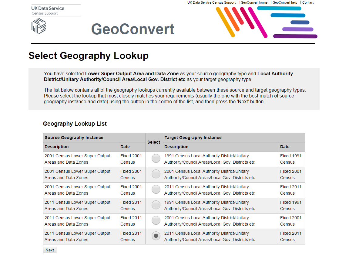
Select the Source geography, which is Lower Super Output Area and Datazone and click 'Next'.
Select the Target geography, which is Local Authority District/Unitary Authority/Council Area/Local Gov. District etc. and click 'Next' once again.
You now have a choice of different years for each geography. Choose the following combination:
2011 Census Lower Super Output Areas and Data Zones to 2011 Census Local Authority District/Unitary Authority/Council Areas/Local Gov. Districts etc.
Click 'Next' to advance.
You now need to upload a file. We have an example file that you can use for this guide here: convert-example-marital-2011lsoa.csv
Click on the link and save it to your computer, from there you can upload it to GeoConvert. The file is a CSV file, so under Column Delimiter Character select Comma. As it has a header row, click Yes in the Header Row section.
If you have your own file, the file must be in plain text format (i.e. .csv NOT .xlsx format). Take a look at the guide to input files for information on further requirements.
Click 'Choose file...', and select the file 'convert-example-marital-2011lsoa.csv' that you downloaded earlier. Click 'Next' and then 'Next' again.
You can now see the results:
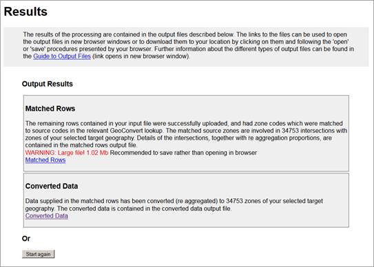
The rows that have been successfully matched, can be found under the Matched Rows link. The file shows you the 2011 LSOA along with the 2011 Local Authority District/Unitary Authority they belong to.
The data converted to the new geography can be found under the Converted data link.
Have a look at both files. The Guide to Output files, gives further information about the types of outputs. The file does not show you the names of the Local Authority Districts/Unitary Authorities, but these can be found on the documentation page.